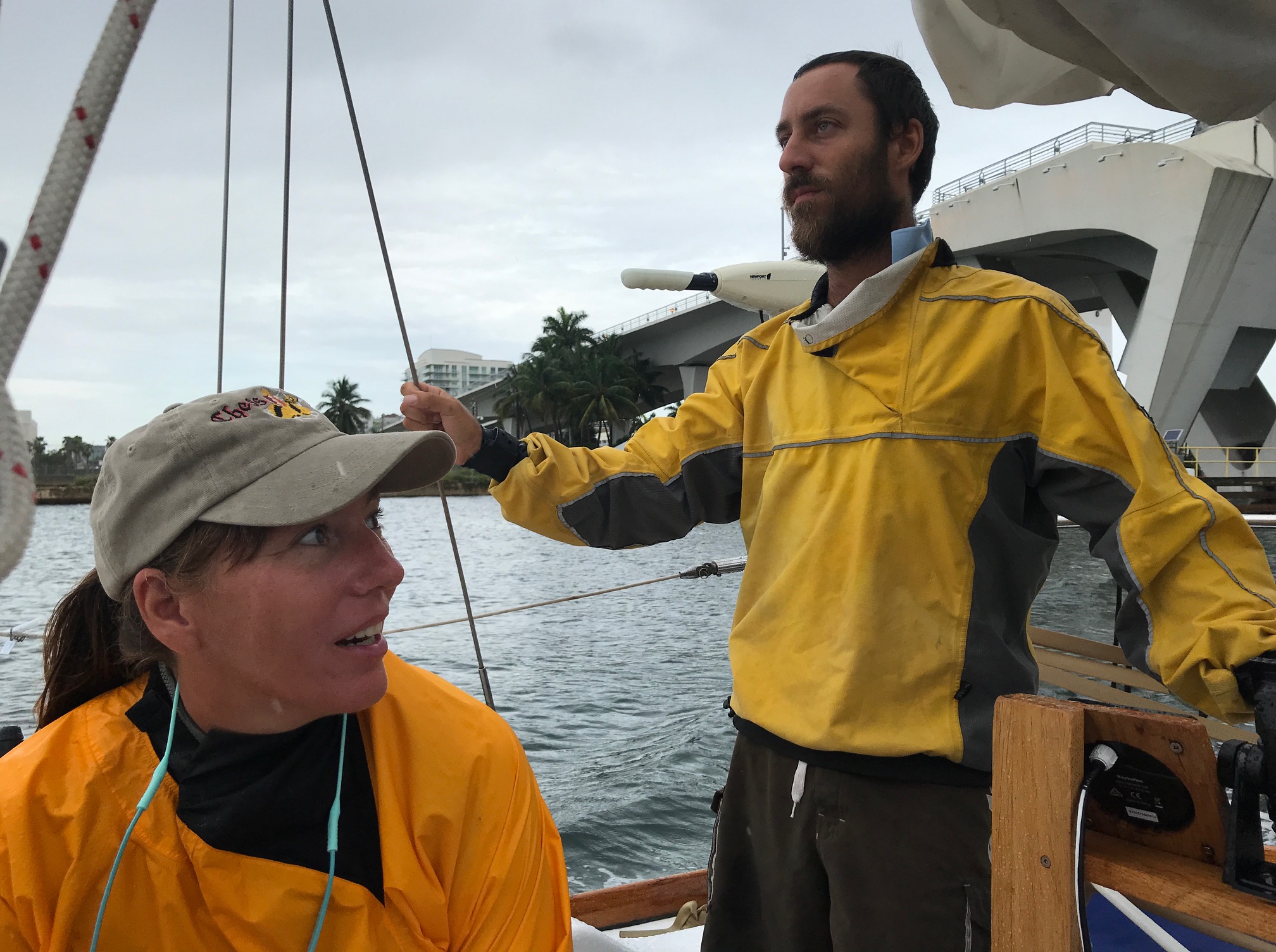
Andi and Matt dressed for foul weather
We’ve been teasing my sailing adventure with my sister and brother-in-law for some time now and it’s time to share some details. I arrived in Fort Lauderdale after driving across the Everglades in a rental car about a week and a half ago to meet Andi, Matt, and their crewmate Sam. I was geared up and ready to hit the high seas for a jaunt to the Bahamas in the 40′ sailing vessel Errant. I’d been preparing for this trip for the last 6-9 months and the time had finally come.
The original plan was for me to sail with them all the way to St. Thomas, but poor timing left me with only a few days aboard. I would be with them for one of the most difficult parts of the journey, crossing the Gulf Stream. The Gulf Stream is a current of warm water that stretches from the tropics and runs along the east coast of the United States from Florida to Newfoundland. The current averages about 50 miles wide and travels northward at around 5 miles per hour. A crossing from Florida to the Bahamas can be difficult if the weather conditions aren’t right, considering you are in the open ocean (aka blue water) during the journey.
The current from the Gulf Stream only adds to that difficulty. For example, if you are sailing in a straight line from Miami to Bimini, Bahamas it’s only 50 or so miles. You travel at 5 miles per hour in a sailboat so you’d figure it’d take you 10 hours to reach Bimini. The current of the Gulf Stream is moving northward at 5 miles an hour, so over the course of 10 hours, you will have drifted north as much as 50 miles, putting you way off target. If you have fair skies and helpful winds from the south you’ll be able to make landfall in Bimini without a problem by making simple course corrections to account for drift.
We were not so lucky.
The moment we left port the sky began to cloud over and the rain started to pound us even before the Florida shoreline disappeared behind us. The seas also began to kick up and we encountered 4-5 foot swells; on a 40′ boat in the middle of the ocean they felt massive as they sent the bow of the boat pitching up and then crashing down into the water covering everything with sea spray. I had to keep my sunglasses on despite the dark sky just to keep salt out of my eyes. The current and the wind pushed us way off course as we found ourselves closer to Freeport, Bahamas than Bimini, a near 60-mile difference north. We then turned into the wind and began to simply power our way through the pitching seas. The sailing term for that — whether under sail or under power — is called “beating into the wind” because you are punished every step of the way.
The foul weather was taking a toll and that convinced Matt that we, the crew, needed a real break, not just the breaks we were getting by sleeping in shifts. We found a semi-sheltered anchorage near Great Issac Cay; we dubbed it Shutter Island for its lighthouse and creepy vibe. Little did we know we weren’t too far off the mark.
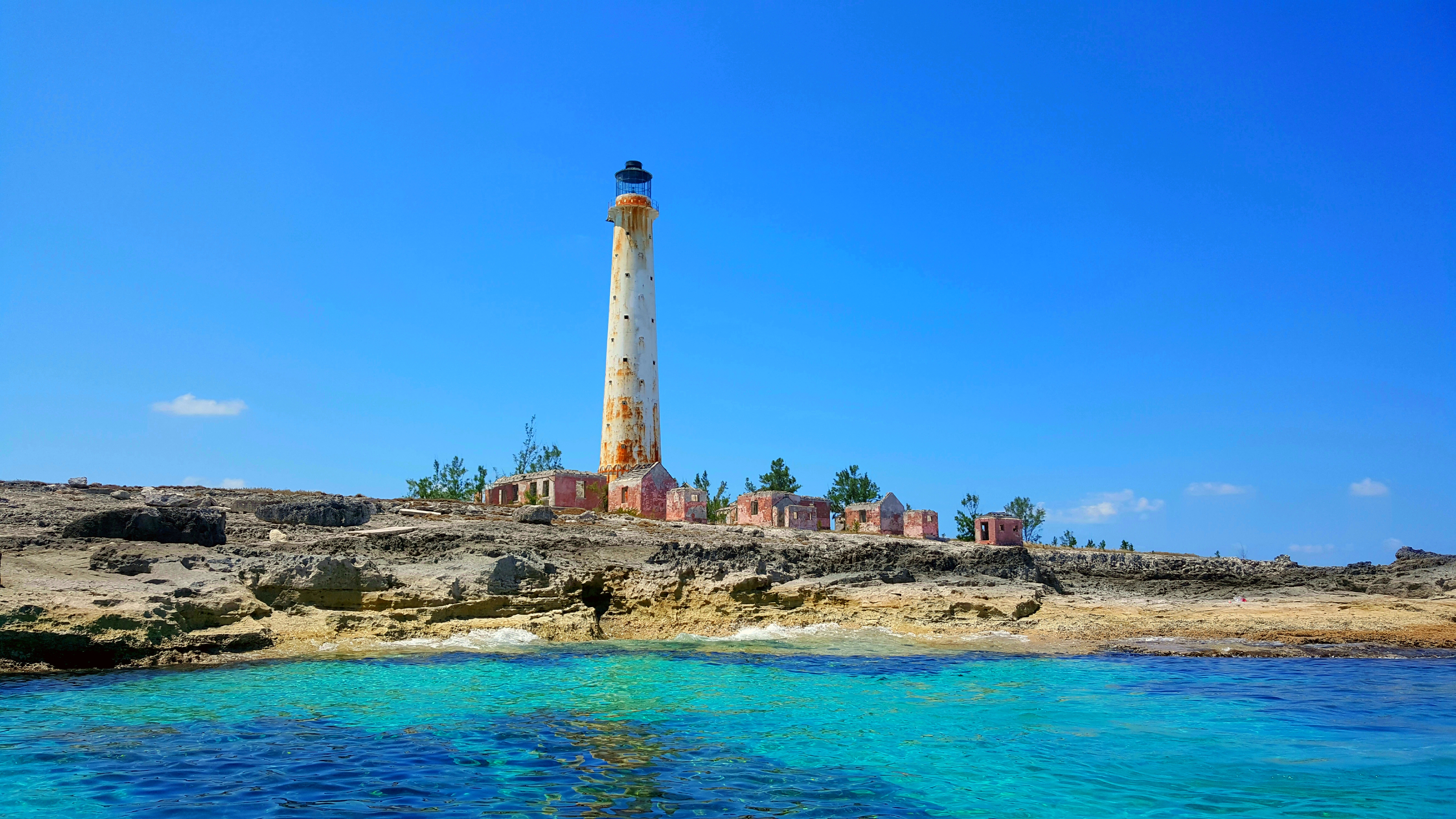
Great Issac Cay
Courtesy – Michael S. King
The most prominent feature of the island is its lighthouse which was erected in 1859 and stands about 151 feet (46 m) tall. It has been claimed that a full moon causes unusual sounds to be heard on the small island. In the late 19th century local lore tells of a shipwreck on the island with one survivor, an infant. The child’s distraught mother, known as the Grey Lady, is said to haunt the island to this very day, wailing in sorrow during the full moon.
On August 4, 1969, the station was discovered to have been abandoned by its two keepers, who were never found…
The next morning we continued our trek southward toward Nassau, alternating between sailing into the wind or with no wind at all the whole way. We had 125 miles to cover and decided to run non-stop, each of us taking a watch of two hours at a time, two hours on, four hours off.
The seas became much calmer as we closed in on the Berry Islands and Chub Cay, a popular spot for cruisers. The depth of the water grew more shallow, around 25 feet, and took on the beautiful turquoise color we associate with the Caribbean as we glided through the flat sea.
The light began to fade just as we came out of the shallows and into the stretch of 40 miles blue water separating the Berrys from Nassau. The night was filled with light, the steady glow of Nassau over the horizon and the frightening power of mother nature all around us. The atmosphere was electric as massive thunderstorms to port and starboard lit up the sky with near-constant bolts of lightning. I was ready to turn and head back to the Chub Cay and ride out the storm there but Matt had us push onward, saying that the storms were to the right and left but not in front of us and we could still see the lights of Nassau. I headed to my berth after my watch and woke up to the feeling of stillness. The boat wasn’t moving, the engine wasn’t running, the world around me was quiet and still. We were at anchor flying the yellow customs flag in Nassau Harbor, and my blue water service was at an end.
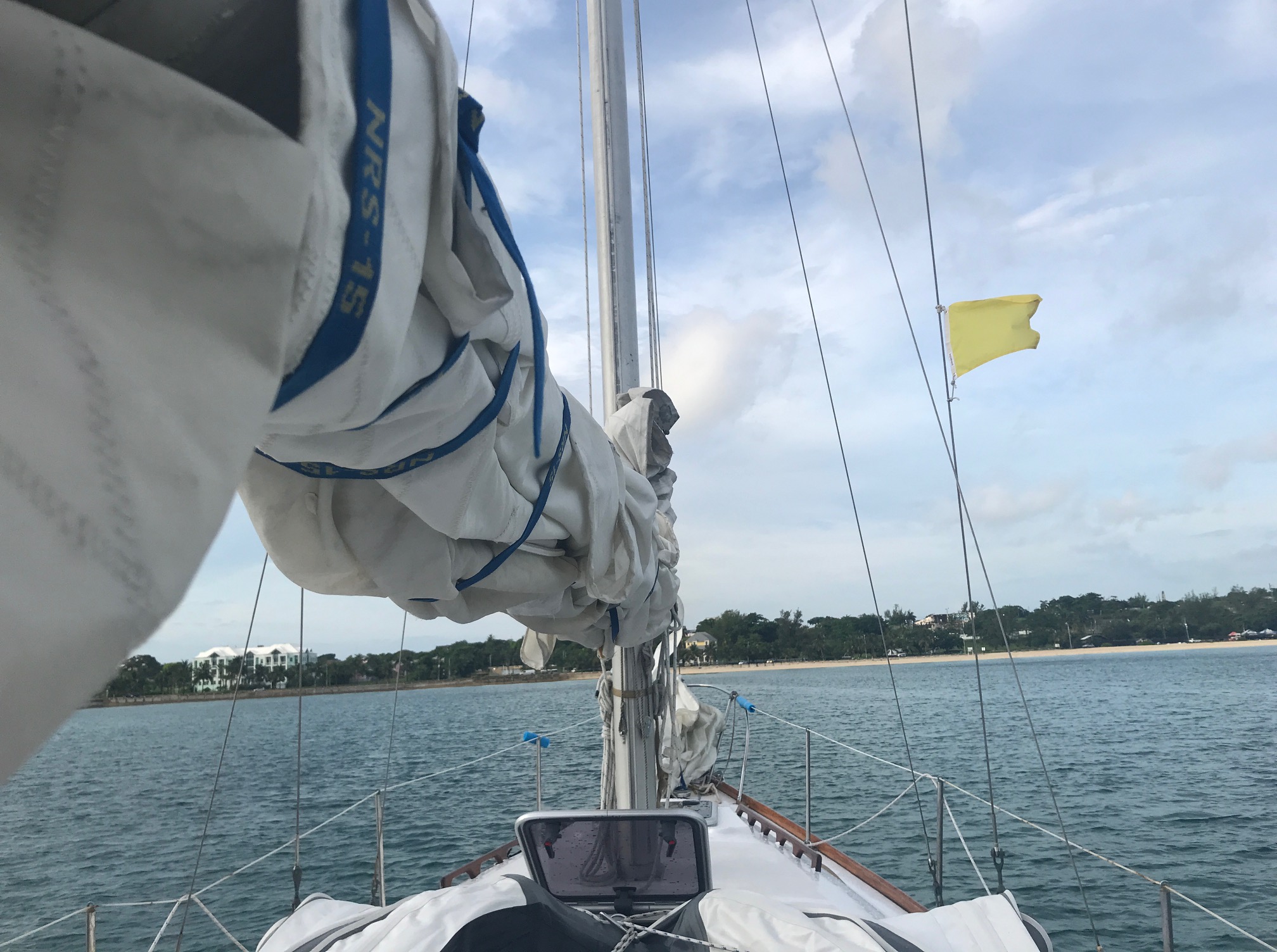
Flying the yellow quarantine flag in Nassau Harbor
